Hurricane Researchers Predicting a Slightly Below-Average Atlantic Hurricane Season for 2017

Colorado State University hurricane researchers are predicting a slightly below-average Atlantic hurricane season in 2017, citing the potential development of El Niño as well as recent anomalous cooling in the tropical Atlantic as primary factors.

hurricane-Felix

So far, the 2017 hurricane season is exhibiting characteristics similar to 1957, 1965, 1972, 1976, and 2002. “The years 1957, 1965, 1976 and 2002 had slightly below-average hurricane activity, while 1972 was a well below-average season,” said Phil Klotzbach, research scientist in the Department of Atmospheric Science and lead author of the report.

The team predicts that 2017 hurricane activity will be about 85 percent of the average season. By comparison, 2016’s hurricane activity was about 135 percent of the average season.

To learn more please click here » »

2016 Hurricane Season Forecast Calls For Near-Average Activity in the Atlantic

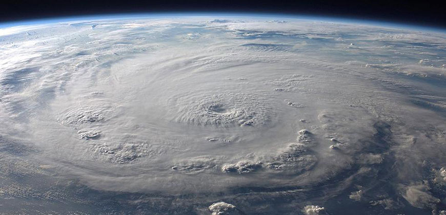
The 2016 Atlantic hurricane season forecast released Thursday from Colorado State University calls for the number of named storms and hurricanes to be near historical averages.

A total of 12 named storms, five hurricanes and two major hurricane are expected this season, according to the forecast prepared by CSU, which is headed by Dr. Phil Klotzbach in consultation with long-time hurricane expert Dr. William Gray.

Learn more at https://weather.com/storms/hurricane/news/2016-hurricane-season-forecast-atlantic-colorado-state-csu

This is close to the 30-year average of 12 named storms, six hurricanes and three major hurricanes. A major hurricane is one that is Category 3 or stronger on the Saffir-Simpson Hurricane Wind Scale.

Numbers of Atlantic Basin named storms, those that attain at least tropical storm strength, hurricanes, and hurricanes of Category 3 intensity forecast by The Weather Company and Colorado State University compared to the 30-year average.

Those seasonal forecast numbers do not include Hurricane Alex, a rare January hurricane that struck the Azores a few months back. Though the official hurricane season spans the months from June through November, occasionally we can see storms form outside those months.

(MORE: Hurricane Alex Recap)

The CSU outlook is based on a combination of 29 years of statistical predictors, combined with analog seasons exhibiting similar features of sea-level pressure and sea-surface temperatures in the Atlantic and eastern Pacific Oceans.

Here are three questions about this outlook and what it means for you.

Q: What Does This Forecast Mean For the U.S.? 

There is no strong correlation between the number of storms or hurricanes and U.S. landfalls in any given season. One or more of the 12 named storms forecast to develop this season could hit the U.S., or none at all. Therefore, residents of the coastal United States should prepare each year no matter the forecast.

A couple of classic examples of why you need to be prepared each year occurred in 1992 and 1983.

The 1992 season produced only six named storms and one subtropical storm. However, one of those named storms was Hurricane Andrew, which devastated South Florida as a Category 5 hurricane.

In 1983 there were only four named storms, but one of them was Alicia. The Category 3 hurricane hit the Houston-Galveston area and caused almost as many direct fatalities there as Andrew did in South Florida.

In contrast, the 2010 season was active. There were 19 named storms and 12 hurricanes that formed in the Atlantic Basin.

Despite the large number of storms that year, not a single hurricane and only one tropical storm made landfall in the United States.

In other words, a season can deliver many storms, but have little impact, or deliver few storms and have one or more hitting the U.S. coast with major impact.

The U.S. averages between 1 to 2 hurricane landfalls each season, according to NOAA’s Hurricane Research Division statistics. However, the number of U.S. landfalls has been much below average in the last decade.

The current 10-year running total (2006-2015) of U.S. hurricane landfalls is seven, according to Alex Lamers, a meteorologist with The National Weather Service. This is a record low for any 10-year period dating to 1850, and is considerably lower than the average of 17 per 10-year period dating to 1850, Lamers added.

(MORE: Hurricane Central)

U.S. hurricane landfalls the last 10 years. Note: Sandy in 2012 is not shown since it officially made landfall as a non-tropical cyclone.

Of course, the record-breaking 2005 hurricane season is now outside that current 10-year running total. 2005 was also the last season we saw a Category 3 or stronger hurricane (Wilma) hit the U.S., the longest such streak dating to the mid-19th century.

(MORE: Florida Hurricane Drought Continues)

Bottom line: The U.S. is due for another hurricane strike sooner rather than later, but it’s impossible to know if that will occur this season. Keep in mind, however, that even a weak tropical storm hitting the U.S. can cause major impacts, particularly if it moves slowly, resulting in flooding rainfall.

Q: Will El Niño or La Niña play a role?

The strong El Niño we saw this winter continues to fade away and may transition to its counterpart La Niña by this fall. Of course, if this handoff from El Niño to La Niña conditions occurs, it could happen during the middle of the 2016 hurricane season.

Klotzbach said that the transition from El Niño to neutral or La Niña conditions during the 2016 hurricane season makes this particular April hurricane outlook very uncertain.

Using the El Niño intensity classification scheme from consultant meteorologist Jan Null, we examined five previous hurricane seasons following strong El Niños. The statistics from each of those seasons is below.

Named Storms Hurricanes Cat. 3+ Hurricanes U.S. Hurricane Landfalls
1998 14 10 3 3
1983 4 3 1 1
1973 8 4 1 0
1966 11 7 3 2
1958 10 7 5 0

As you can see, there’s quite a spread, ranging from a record low four named storms in 1983 to 14 such storms in 1998.

The 1998 season featured seven U.S. landfalling tropical cyclones, three of which – Bonnie, Earl, and Georges – were hurricanes at landfall.

Despite only four named storms in 1983, two of those made U.S. landfall, including Category 3 Hurricane Alicia in southeast Texas.

This again illustrates the poor correlation between the number of named storms or hurricanes and landfalls.

In all, there have been a total of six U.S. hurricane landfalls in the five post-strong El Niño seasons dating to 1958, for an average of roughly one a season. Two of those five seasons were without a U.S. hurricane landfall, however.

Klotzbach found that the chance of a U.S. hurricane impact rises dramatically in a La Niña or neutral (neither El Niño or La Niña) season compared to an El Niño season.

Without El Niño contributing to stronger wind shear and dry air in the Caribbean Sea like we saw in 2015, it at least loads the dice toward an increased chance of tropical cyclones surviving into the Caribbean Sea, or forming there in 2016, particularly later in the season as El Niño disappears farther in the rear-view mirror.

Q: What Other Factors Are in Play?

The three previous Atlantic hurricane seasons featured either few named storms (2014; 8) or a greater number of storms, but few of which survived long or became hurricanes (2013 and 2015).

2013 and 2014 featured prohibitive dry air and/or wind shear during a significant part of the season, but El Niño was nowhere to be found.

In 2015, El Niño likely played a significant suppressing role in the 2015 Atlantic hurricane season. Klotzbach found that June through October 2015 Caribbean wind shear was the highest on record dating to 1979. Klotzbach also said the magnitude of dry air over the Caribbean Sea in the peak season month of August and September also set a record.

2015 Atlantic Tropical Cyclone Tracks

As you can see, dry air and wind shear can detrimental to tropical storm or hurricane development no matter whether El Niño is present or not. This is one factor to watch for in the 2016 season.

Klotzbach said that wind shear enhanced by El Niño is likely to dissipate the next several months. However, he added that the northern Atlantic Ocean has water temperatures that are colder than average which can cause atmospheric conditions to be unfavorable for the development and strengthening of Atlantic hurricanes.

MORE ON WEATHER.COM: H

2016 Atlantic Hurricane Season Predictions & Forecasts

Hurricane activity in January … what gives?

http://www.interstaterestoration.com/blog/just-2016-atlantic-hurricane-season-forecast

If you follow the news, then you may have noticed some headlines the second week in January about an unusual Atlantic disturbance.1 In fact, the disturbance turned into Hurricane Alex, making it the first hurricane of 2016—and only the second hurricane on record in January since 1938.2 In the end, Alex was downgraded to a tropical storm before it made landfall in the Azores, but it’s still quite a way to open the year. Especially given the long stretch of uneventful hurricane seasons that now stretches back to 2005.3

Does that mean we’re finally in for a big season this year?

Leading scientists and meteorologists can’t say for sure, but they have started releasing forecasts and predictions. Before we delve into the 2016 Atlantic basin hurricane season, which runs from June 1 through November 30, let’s revisit key data points from the 2015 season.

2015 Atlantic Hurricane Season Recap

In our 2015 hurricane season forecast post, we highlighted predictions from The Tropical Meteorology Project at Colorado State University as well as from the UK-based Tropical Storm Risk (TSR) project.
TSR forecast that the 2015 season would be 20 percent below long-term averages, with up to 13 tropical storms, six hurricanes and two intense hurricanes.4TSR’s predictions were in line with the Tropical Meteorology Project, whose early qualitative forecast for 2015 included four scenarios, one of which predicted that there was a 40 percent chance there would be 8-11 named storms, three to five hurricanes and one to two major hurricanes.5

The 2015 season closed with a total of 11 named storms, including four hurricanes and two major hurricanes, so predictions that the season would be below average were accurate.6 The Tropical Meteorology Project noted that one of the more notable facts about the 2015 season was that one storm (Joaquin) accounted for almost half of the entire season’s Accumulated Cyclone Energy (ACE).7

What’s also notable for 2015, is that while the Atlantic basin season was below average, the eastern and central pacific seasons both set some new records,8including the record for strongest hurricane (Patricia).9

2016: What the Experts are Saying

For 2016, many of the main signals that forecasters monitor point to a below-normal Atlantic basin hurricane season, but they caution that the ultimate outcome may depend on how the end of the current El Niño pattern plays out.10

The Tropical Meteorology Project based its four predictions for 2016 on the strength of the Atlantic Multi-Decadal Oscillation (AMO) or Atlantic thermohaline circulation (THC) and the phase of the El Niño Southern Oscillation (ENSO), all of which are discussed in its December report, if you are interested in learning more about the technical side of their predictions.11 Technical speak aside, what’s important to understand is how forecast numbers add up in comparison to Accumulated Cyclone Energy (ACE) averages over the years, since ACE averages are a reliable indicator for the amount of tropical cyclone activity that can be expected in a given season. For 2016, the Tropical Meteorology Project has projected the following as being the most probable scenarios:12


To bring the forecasts closer to home, it’s also helpful to look at the probability of individual states being hit by hurricanes. For 2016, the Tropical Meteorology Project has calculated state-by-state climatological probabilities as follows:13

TSR, which primarily relies on “July-September trade wind speed over the Caribbean Sea and tropical North Atlantic,” for its early predictions is projecting that the 2016 season will be below average. TSR has projected that the ACE Index for the year will be roughly 79 (with a standard deviation for errors of plus or minus 57). That correlates to roughly two (plus minus two) intense hurricanes, five (plus or minus three) hurricanes and 13 (plus or minus five) tropical storms. TSR puts the probability of an above average season at 25%, a near-normal season at 34% and a below-normal season at 41%, but notes that historically the accuracy of forecasting models in December is low compared to August forecasts.14 

Don’t Bank on Good Fortune

While there are a lot of really smart people working on hurricane forecasts, nobody really knows what is actually going to happen in 2016. Remember that the year started with unusual activity, and the hurricane season is still months away. That’s why now is the best time to start making sure your workplace is prepared for a hurricane and that your disaster recovery plan is up to date.

Sources:
1 Atlantic Disturbance Could Become Unusual January Subtropical Storm, Weather Underground, January 13, 2016.
2 Rare January Hurricane Alex Landfalls in The Azores as a Tropical Storm, Weather Underground, January 15, 2016.
3 No Major Hurricane Has Made Landfall In the U.S. In More Than 9 Years — and That’s a New Record, The Weather Channel, May 1 2015.
4 Extended Range Forecast for Atlantic Hurricane Activity in 2015, Tropical Storm Risk, December 9, 2014.
5 Qualitative Discussion of Atlantic Basin Seasonal Hurricane Activity for 2015, Department of Atmospheric Science, Colorado State University, December 11, 2014.
6 Below-normal Atlantic hurricane season ends; active eastern and central Pacific seasons shatter records, National Oceanic and Atmospheric Administration, December 1, 2015.
7 Summary Of 2015 Atlantic Tropical Cyclone Activity And Verification Of Authors’ Seasonal And Two-Week Forecasts, Department of Atmospheric Science, Colorado State University, November 30, 2015.
8 Below-normal Atlantic hurricane season ends; active eastern and central Pacific seasons shatter records.
9 Hurricane Patricia Recap: Strongest Landfalling Pacific Hurricane on Record, The Weather Channel, October 24, 2015.
10 Does a Weakening El Niño Mean a More Dangerous 2016 Atlantic Hurricane Season?, The Weather Channel, January 2, 2016.
11, 12, 13 Qualitative Discussion Of Atlantic Basin Seasonal Hurricane Activity For 2016, Department of Atmospheric Science, Colorado State University, December 11, 2015.
14 Extended Range Forecast for Atlantic Hurricane Activity in 2016, Tropical Storm Risk, December 16, 2015.

11 Worst Hurricane’s

The 11 Worst Hurricanes

For many South Floridians, the big question during hurricane season is: What’s it like? Every storm is different, but one way to answer that question is to explore hurricane history. Here you’ll find profiles of storms that South Florida will never forget. For each storm, we’ve gathered storm data, photos and the front page of the Fort Lauderdale News or Sun-Sentinel, from which we’ve reproduced a news article on the storm.

1919 – Key West

Key West was hit by the most powerful hurricane in its history on Sept. 10, 1919. It was the only hurricane to form in the Atlantic that year. The storm killed more than 800 people before it was done — the exact total will never be known.

September 19, 1993

1926 Miami: The blow that broke the boom

The 1926 storm was described by the U.S. Weather Bureau in Miami as “probably the most destructive hurricane ever to strike the United States.” It hit Fort Lauderdale, Dania, Hollywood, Hallandale and Miami. The death toll is estimated to be from 325 to perhaps as many as 800. No storm in previous history had done as much property damage.

September 11, 1988

HURRICANE

1928 – Okeechobee

When the hurricane roared ashore at Palm Beach September 16, 1928, many coastal residents were prepared. But inland, along Lake Okeechobee, few conceived the disaster that was brewing. The storm struck first in Puerto Rico, killing 1,000 people, then hit Florida with 125 mph winds. Forty miles west of the coast, rain filled Lake Okeechobee to the brim and the dikes crumbled. Water rushed onto the swampy farmland, and homes and people were swept away. Almost 2,000 people perished.

1935 – The Florida Keys

The Labor Day storm was a category 5 hurricane that killed 408 people in the Florida Keys. People caught in the open were blasted by sand with such force that it stripped away their clothing.

1960 – Hurricane Donna

After swiping the Florida Keys and striking land near Fort Myers on Sept. 10, ‘Deadly Donna’ did not travel along the usual path that storms of her magnitude usually take.

1964 – Hurricane Cleo

Hurricane Cleo blasted Key Biscayne and then moved north along the state’s coastline, following State Road 7 and passing over Miami, Opa-locka, West Hollywood and Fort Lauderdale.

1965 – Hurricane Betsy

Hurricane Betsy was building strength; it looked like it was aiming for South Carolina, posing no threat to South Florida. But on Saturday, Sept. 4, the storm whirled to a stop, about 350 miles east of Jacksonville. When Betsy started moving again on Sunday, she had changed directions. The storm plowed through the Bahamas Monday night, then mauled South Florida a day later.

1992 – Hurricane Andrew

For 27 years, South Florida had been spared a severe hurricane. Then Andrew arrived, the most expensive natural disaster in U.S. history. Andrew wrecked more property than Hugo, Agnes and Betsy combined, with damages estimated at $25 billion. Twenty-three died.

2004 – Hurricane Frances

Hurricane Frances, a sluggish and super-sized storm, may leave as its legacy a singular image: The entire state of Florida, 435 miles from Tallahassee to Key West, enveloped in rain and wind.

2004 – Hurricane Jeanne

Hurricane Jeanne pushed across Florida, launching leftover storm debris, tearing apart weakened buildings, cutting power for millions, and leaving the nation’s fourth most populous state dazed by relentless pounding from four hurricanes in six weeks. At least six people died during and after the storm.

2005 – Hurricane Wilma

Hurricane Wilma clobbered South Florida on Monday, October 24, 2005, with surprising strength, leaving the entire region damaged, dark and startled by the ferocity of a storm that many hadn’t taken seriously enough.